Skip to content
Boston Society of Architects

Port Feature

Arriving / Departing

Navigating the turbulent divide between land and sea

Print HAM 0870

Floating Garden, by Motoi Yamamoto, 2013, composed of salt. After each installation, the salt is returned to the sea.

Courtesy © Motoi Yamamoto

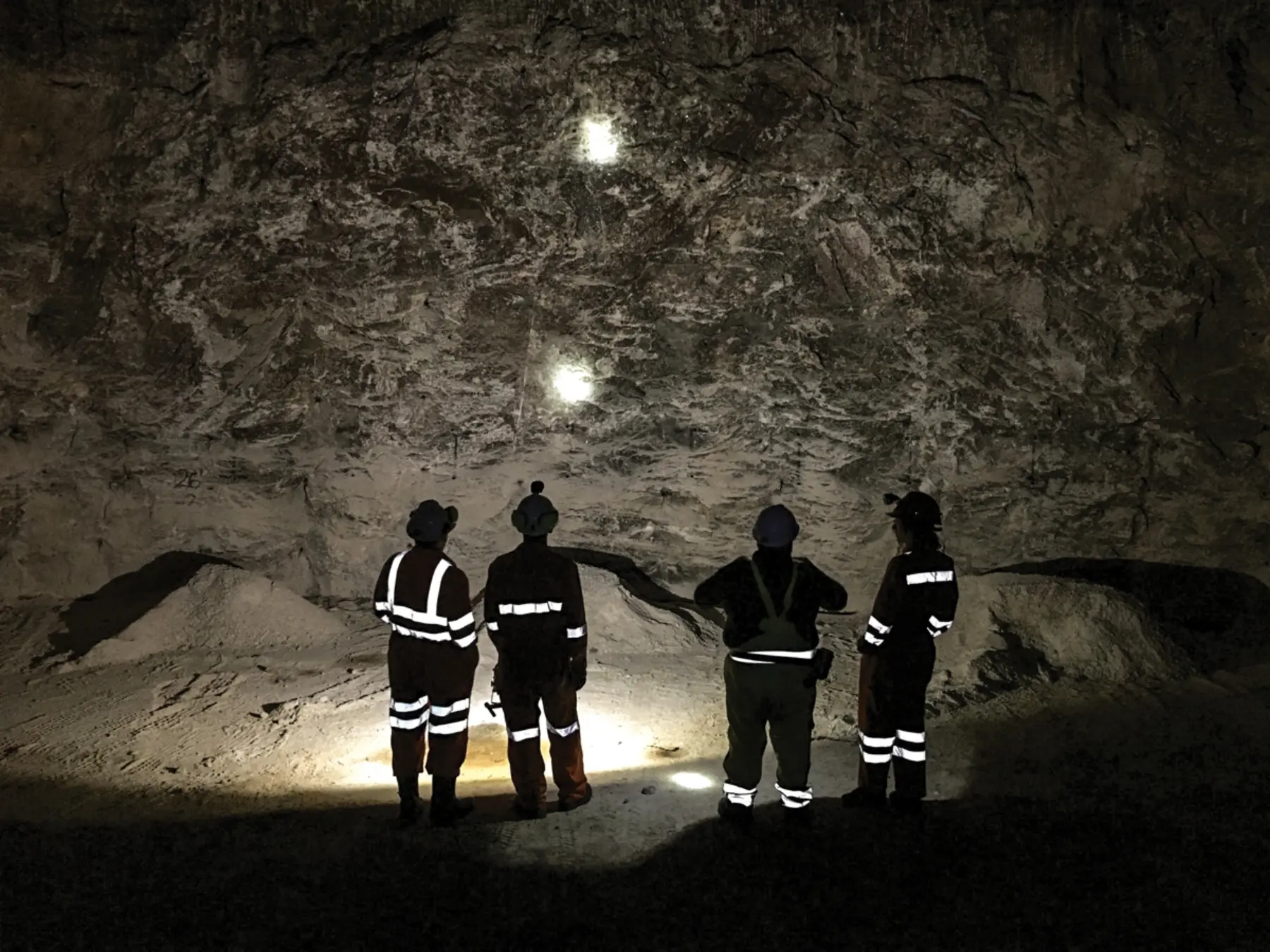
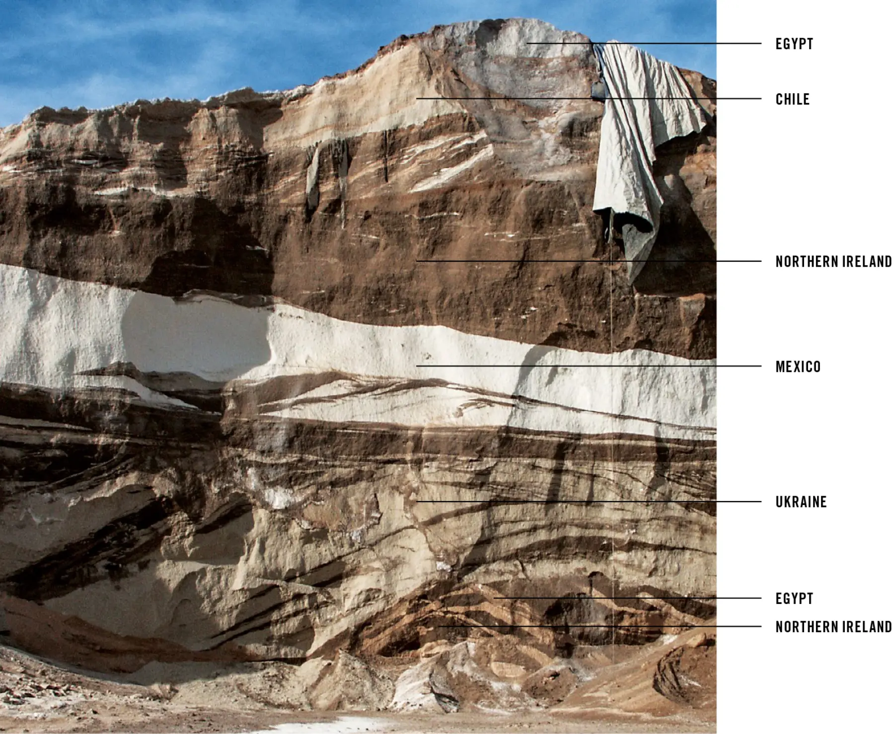
When you follow behind a salt truck on the highway, watching crystals spiral out of a spreader, you are witnessing part of a vast material network facilitated by the Port of Boston. This salt might be from the Zechstein Sea, 250 million years old, which evaporated during the Permian era and is now mined 1,200 feet underground in Northern Ireland or Poland. Humble road salt helps tell the story of the seaport’s profound role in translating the scale of global goods arriving by water and moving onto local roads.

Salt is delivered in 50,000-ton packages (ships) from across the sea, stockpiled and redistributed into 30-ton deliveries (trucks), and received in public works sheds or tucked under highway viaducts, ultimately to be spread across highways, runways, docks, parking lots, driveways, stoops, and patios throughout the region. The port facilitates this massive downscaling and dispersal of resources, a fantastical moment of global convergence.

Towns from Bedford, Massachusetts, to Bedford, New Hampshire, depend on this infrastructural flow of resources for goods delivery, just as Boston depends on distant landscape resources such as the Quabbin Reservoir (water) or the European Permian Basin (salt). In planning Boston’s waterfront today, consideration of port operations is crucial—yet it is often an awkward fifth wheel in conversations about recreation, flooding, real estate, and ecology.

Access to the shoreline is difficult to reconcile with security perimeters around marine terminals. Kayaks (7 feet long) and Panamax vessels (700 feet long) are mismatched partners. Seawalls that block surges also block ship routes, and living shorelines conflict with deep-draft vessel mooring. Dredging and pile driving uproot shellfish and plant life. Luxe waterfront condos constrict truck routes and other noisy, messy processes inherent to dispersing goods into a city. These conflicts between city and port persist despite Boston’s origins as a city birthed from trade across the sea. Designing the shoreline as a shared resource between city life and port operations remains the great challenge in considering the waterfront’s future.

The distinction between the port and the city is important. The port is not Boston’s. Even the traditionally recognized boundaries extend outside Boston into Chelsea, Everett, and Revere. The seaport is not a singular artifact; it is an assembly of thousands of infrastructural elements that bridge the turbulent divide between sea and land—berths, piers, wharves, bulkheads, bollards, and fenders were built discretely over hundreds of years but today form a continuous linear chain that wraps nearly the entire coastline.

Neither is the port an isolated artifact: numerous upland communities of the Charles, Mystic, and Chelsea River watersheds are hydrologically linked to the harbor, where sea-, road-, rail-, and airways converge to facilitate the movement of goods and people, collecting and dispersing resources like a two-way funnel. (Salt arrives in big ships and disperses in little vehicles into the city; little bits of metal-like cars, toasters, and chain-link fences condense at portside scrapyards into mountains of rusting steel and ship out in massive packages across the globe for recycling.)

Herein lies one of the most challenging aspects of waterfront design: It is local, regional, and global all at once, which can create conflicts among competing interests. Although Boston might benefit from converting a waterfront scrap-metal terminal into a recreation landscape or might generate more property taxes with new condominium development, how do such developments benefit all the communities between Williamstown or Provincetown? These towns depend on and benefit from port operations in Everett for collecting and shipping out their scrapyard steel.

The port’s value crosses municipal boundaries. Its most critical infrastructure—the Federal Navigation Channel, a dredged deep-draft channel that runs underwater from the outermost Harbor Islands to the Route 99 bridge in Everett and the former Forbes Lithography plant in Chelsea—is federal. The dredging-based construction and maintenance, orches­trated by the US Army Corps, is paid for in large part through state and federal taxes, so the infrastructure is not the property of Boston. Landscapes that abut these channels are almost entirely former tidelands that were filled to create cargo laydown and stockpiling or trans-shipment areas within a crane’s swing to deep water. In this way, these waterfront lands are inherently married to the construct of the channel, and because these lands were once water, the public has embedded rights of access and use through the state law known as Chapter 91.

These lands should be dedicated to advancing the public’s common wealth. The constructed waterfront, because of these embedded public rights as well as historic state and federal investment, is not a simple land commodity but a national resource. This history of regional investment in the infrastructure and the landscape makes the definition of “public” complicated. The public that benefited from historic federal port investment and sacrificed commonwealth rights to filled tidelands is not just confined to Boston city boundaries,but is a public that is spread throughout the state and the region. Therefore, any redevelopment of this landscape should serve not only the interests of the city but also the broader commonwealth of the region.

The port houses critical infrastructures and industries that function like keystone species in an ecological web. Displacing one of these functions has a cascading effect on the performance of regional infrastructure. For example, if the closure of a marine terminal causes the rerouting of a single ship carrying 50,000 tons of cargo from Boston to Newark, then it takes more than 1,500 trucks to bring that same cargo from Newark to Boston. Effectively, one ship mile becomes 1,500 truck miles. Transport over water consumes significantly less fuel than trucks—a gallon of fuel can move goods nearly 10 times farther over water than over land, emitting less particulate matter and relieving roadway congestion. In Boston, when a marine terminal is replaced by a waterfront amenity or new development, local benefits might be seen, but the costs are quietly dispersed across a region.

The keystone species metaphor is also applicable to ports when considering a region’s economic diversity. Ships and marine terminals are largely automated today, with minimal direct employment of crews or terminal operators. This can make it complicated to argue for the economic and cultural value that such operations embed into the urban environment. Wouldn’t a park benefit more people? Wouldn’t construction create more jobs?

Port operations trigger diverse indirect trades. When a ship docks in a city, there is a ripple effect through the local economy: Coast Guard officials certify, harbor pilots navigate, health inspectors inspect, customs agents process, labs test, tug crews tow, line-handlers moor, chandlers deliver, welders fix, barges refuel, new crew arrive at the airport, longshoremen unload, machine operators scoop and dump, truck drivers queue. When such operations are displaced from cities, the diverse economies, skills, and associated diverse cultures of people are eliminated. The city becomes more monocultural.

A cascading loss occurs when the critical mass of operations becomes so reduced as to no longer support others. If dry docks and their associated painting, welding, and machining shop operations collapse, then the ship fleet that depends on these services must find such support further afield, making them more prone to collapse themselves. The workings of the port are a delicate interdependent ecosystem.

Today, it is common for cities such as Boston to be identified as postindustrial, a strange reality given that the city’s dependence on industrial processes and industrially produced goods has only grown, while simultaneously the city has become less perceptually connected to its own industrial footprint. Instead of drawing from local communities, the city forges infrastructural relationships across the globe. The port is a rare landscape where these relationships are pronounced. Architectures such as liquid storage tanks; grain or gypsum silos; and stockpiles of bulk material such as salt, gravel, sand, cobbles, roll-on/roll-off yards for cars, or laydown yards for shipping containers, make the various materials and quantities that support the city apparent. Similarly, piles of scrap metal or municipal solid-waste depots make visible the collective byproduct of the region’s day-to-day life. Such transparency is necessary if residents are to understand how their city works and make informed decisions about their actions: When I use something, where did it come from? Who made it? Was it fair and just?

The architecture of the built environment plays a pivotal role in either revealing or shrouding the systems and resources that sustain a place, and ports are central to this process. When ports are a part of everyday life, the material flows that sustain the city can be confronted, considered, and accounted for; when they are cast away, these systems are undetectable and incoherent: out of sight and out of mind. In this way, the designed relationship between a city and its material networks plays a significant role in either empowering or disempowering people to wisely participate in the systems that support the city.

Today, urban waterfronts are increasingly contested environments between demands for recreation, ecologic performance and habitat, coastal defense, real-estate value, and global infrastructural utility. None of these uses is incompatible; the compatibility of each is a matter of design. Density in cities is a positive trait, but too often it is measured through people per acre or square footage of architecture develop­ment. Positive urban density should account for what a city does: how much it stands on its own resource networks, is a resource for other communities, and accounts for its own footprint.

Related