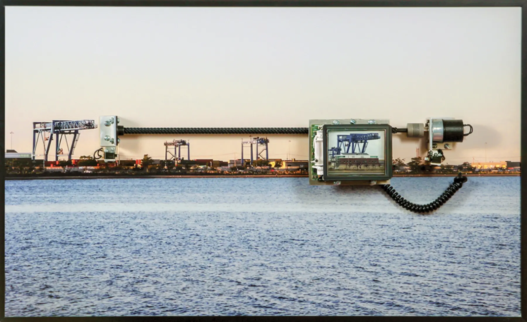
Boston’s port was once centered at Long Wharf; now it’s scattered across several miles. Massport runs the large container facility at Conley Terminal in South Boston, as well as a cruise ship terminal, the Boston Fish Pier, and an autoport in Charlestown, which processed nearly 80,000 cars in 2017. Privately owned terminals along the Chelsea and Mystic rivers handle natural gas, petroleum, jet fuel, salt, cement, and bulk cargo.
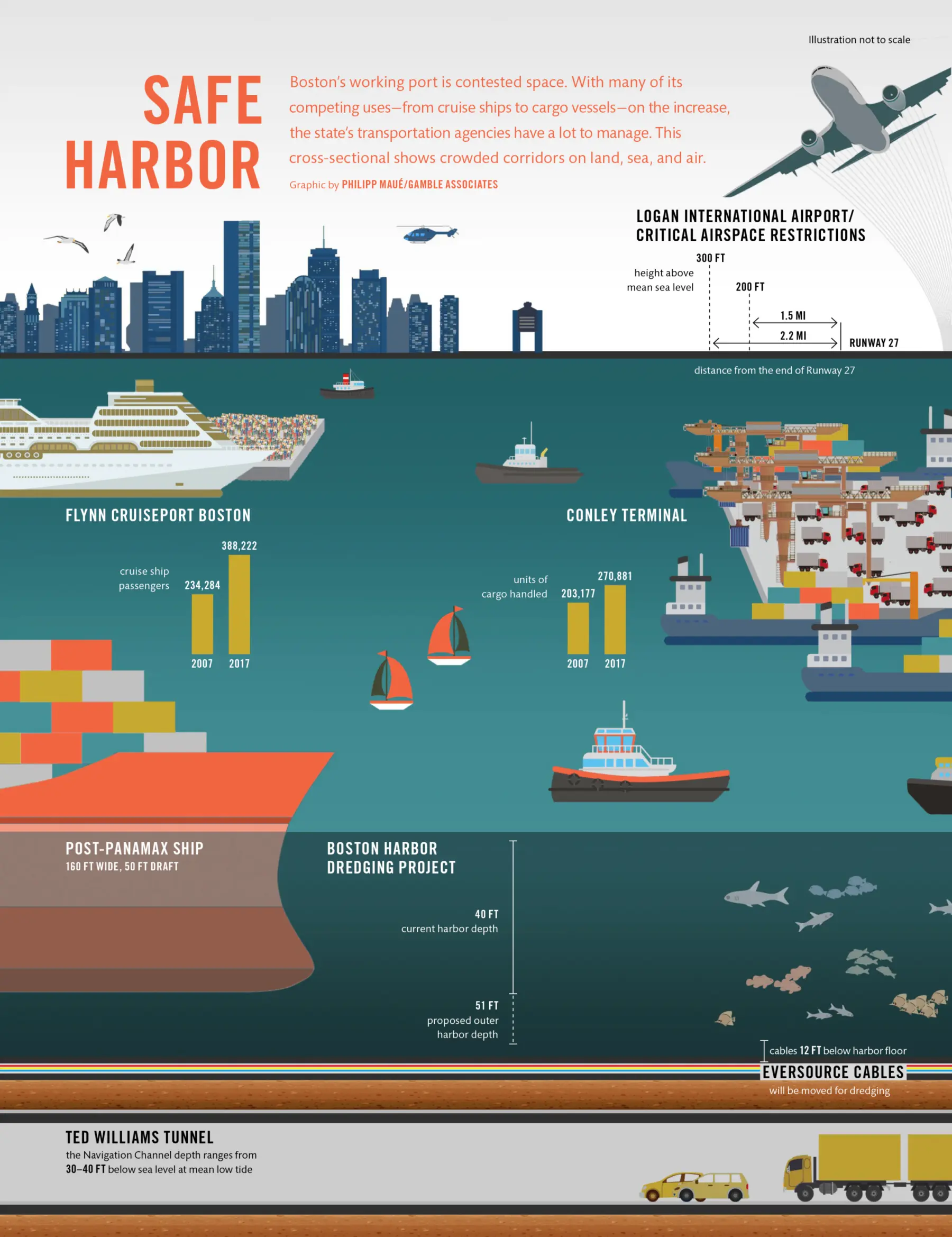
Boston Harbor is relatively shallow, with an average depth of just 15 feet. The port has long battled that shallowness to clear a path for ships, with channels that have deepened to keep up with changing shipping technology. The most recent major deepening, in the late 1990s, brought the Reserved Channel in South Boston to a 40-foot depth, allowing increasingly large container ships to reach Conley Terminal and help maintain a reasonably competitive port in an economically depressed city.
Now, Boston is again in an underwater competition to maintain its status as a container port, spurred by a recent expansion of the Panama Canal. Completed in June 2016, the canal’s new locks can accommodate so-called post-Panamax ships more than 160 feet wide with nearly 50 feet in draft (the former limits were 106 feet in width and 39.5 feet in draft) and carrying nearly three times the cargo.
In 2017, Massport launched a $350 million dredging project with federal and state funding, which will deepen the Outer Channel from 40 to 51 feet, and the Main Channel and Reserved Channel serving Conley from 40 to 47 feet. According to Massport, the new dimensions will help preserve shipping to terminals in Chelsea and the Mystic River while giving Conley the capacity to serve post-Panamax ships carrying up to 12,000 20-foot equivalent units of cargo, with the largest ships taking advantage of high tides to squeeze in. A newly built Dedicated Freight Corridor through South Boston will help speed the landside transportation of a growing volume of cargo in the future, while buffering neighborhood streets from traffic.
Ports must accommodate bigger ships or face a future of diminishing relevance. Cities up and down the East Coast have been investing billions of dollars to carve out channels that will accommodate these behemoths; it’s an opportunity to gain market share over West Coast cities, which have dominated shipping from East Asia since the 1980s, by luring post-Panamax ships from Asia directly through the canal.
Harbor deepening, though less visible than a new highway or a major airport, is an alteration of urban infrastructure with economic and environmental consequences. Collectively, harbor expansions help to make the global flow of materials and goods more efficient; if cities are hubs of energy, materials, and consumer goods, an expanding fleet will speed up the “metabolism” of these resources. Locally, dredging projects pose both an opportunity and a gamble for port cities. A port’s success does not rely on physical infrastructure alone, but on the dynamics of a vast global economy and competition among neighboring ports.
Is it worth the trouble to keep deepening Boston’s channels? The city’s port is not an economic powerhouse: According to the US Bureau of Transportation, it ranks 39th in the US in tonnage, well behind other East Coast ports such as New York–New Jersey; Savannah, Georgia; Norfolk, Virginia; Baltimore; and Pittsburgh. But numerical rankings don’t fully capture a port’s value to a city: the sense of historical identity and the economic and cultural vibrancy of a working waterfront.
Boston is the only New England port capable of handling deep-draft container ships. In recent years, it has lured in more shipping lines from New York–New Jersey to gain a greater share of New England–bound cargo, with a promise of lower landside transportation costs to those markets. Increasingly, more cargo has been hauled in and out of Conley Terminal.
In spite of the continued usefulness of Boston’s port, the reality is that if the market were the only factor, its terminals might be swallowed by other land uses.
Boston’s port areas owe their viability to a collection of laws and legal doctrines that span millennia. The Public Trust Doctrine, dating back to the Byzantine empire’s Code of Justinian, characterizes the sea and shoreline as so important to society that they must be protected for the public to engage in fishing, commerce, and navigation. That tenet made its way through English common law and into the Commonwealth’s Waterways Act of 1866, revised over time and referred to today as Chapter 91.
The law protects public access to the shoreline and largely restricts development in tidal areas (even those filled in for centuries) to water-dependent uses.
When coastal waterways were polluted and ports were unsightly, these functions had little interference. But as waterfronts got cleaner, pressures changed. The Coastal Zone Management Act of 1972 offered federal guidance and resources to states to implement coastal management plans, which include protecting port activities. One of Massachusetts’ responses was to delineate Designated Port Areas (DPAS) suitable for marine industrial uses, with three essential components: a developed waterfront area capable of supporting commercial navigation; adjacent “backland space” to accommodate the physical layout and use of industrial activity; and land-based transportation links and utility services.
Beginning in the 1980s, state officials carved out DPAS along Massachusetts waterfronts. Out of the 10 current DPAS, the Boston metro area is home to four—in South Boston, East Boston, and along the Mystic River and Chelsea Creek—and each DPA has multiple wharves or terminals. Collectively, they span hundreds of acres of land and acres of water adjacent to them.
The purpose of DPAS is to protect working waterfronts through the rise and fall of a city’s economic fortunes. “Port space is a nonrenewable resource and irreplaceable,” says Dennis Ducsik, who helped write the rules governing DPAS as the Commonwealth’s tidelands policy coordinator from 1985 to 2012. If a port or marine industry gets swallowed up by other uses, it may never come back. “Of course, the market abhors a vacant lot like nature abhors a vacuum,” he says, “and there’s inexorable pressure to fill the space.”